
Categories
GalvestonWhat is an elevation certificate and why does it matter for Gulf Coast homebuyers?
An elevation certificate is a FEMA/NFIP form that documents a building's location, flood zone, and elevation characteristics relative to the base flood elevation (BFE) for that site. On the Texas Gulf Coast, where a significant portion of homes sit in or near FEMA-designated Special Flood Hazard Areas, that document can be the difference between a manageable insurance premium and one that stops a deal cold. According to the FEMA Elevation Certificate glossary, the form is developed for communities to meet elevation-documentation requirements and can also be used by property owners to obtain flood insurance.How elevation certificates work in Galveston County
The Texas rule: not required, but often worth it
Here is the first thing I tell every buyer who asks me about flood insurance on a coastal property: Texas has changed the rules. According to the Texas Water Development Board, an elevation certificate is no longer required to purchase flood insurance under the NFIP. But, and this matters, it can still be submitted if it lowers your premium. That distinction is huge. A home that sits higher than its BFE may qualify for a meaningfully lower rate once the certificate is in front of the insurer. A home that sits below BFE will tell you exactly how much risk you're taking on before you close.The practical takeaway: even if your lender doesn't require one, asking for it early in the option period is one of the smartest moves a coastal buyer can make.
Where the certificate comes from
Texas does not keep elevation certificates on file at the state level. The Texas Water Development Board confirms that the document hunt should start locally, with the local floodplain administrator. Galveston County's floodplain FAQ confirms that residents can obtain an elevation certificate or survey through their local process, and the county notes that buyers and agents should check whether one already exists before ordering a new one. If the seller, a prior surveyor, or the local floodplain office already has one on file, you may not need to commission a new survey at all.Galveston City's local standards
The City of Galveston has its own layer of requirements on top of federal rules. According to the City of Galveston's flood-protection page, all new construction and substantial improvements must be built at least 18 inches above the base flood elevation under city standards. That local design rule matters when you're comparing an older 1970s beach cottage to a newer elevated rebuild, the newer home is almost certainly sitting higher, and that elevation difference shows up directly in the insurance quote.The city also defines "substantial improvement" or "substantial damage" as reaching 50% of the structure's market value. If a home you're considering has storm damage, or if you're planning renovations, that threshold is a critical number. Once repairs or improvements cross that line, the structure must be brought into compliance with current floodplain standards, which means permits, elevation certificates, and building to the current minimum elevation. I always flag this for buyers looking at older waterfront homes that show signs of prior storm damage.
Reading the flood maps
Before you even think about an elevation certificate, you need to know what flood zone the property is in. Galveston County maintains an official page for current and historical FEMA Flood Insurance Rate Maps (FIRMs), which is the best county-level starting point for comparing a property's flood exposure over time. For a quick address-level check, FEMA's National Flood Hazard Layer viewer lets you search by address and print a FIRMette, the standard federal map-check step before ordering or interpreting an elevation certificate.Two specific map dates worth knowing: both the City of Galveston and League City reference an effective FIRM date of August 15, 2019 on their current flood-protection pages. If you're comparing properties across multiple Galveston County municipalities, say, a home in Galveston versus one in League City or Dickinson, the flood-zone determination should be tied to the exact municipal map in force for that property, not a generic county assumption. Your agent or title company can help you confirm which map applies.
| Document / Resource | What It Tells You | Where to Get It |
|---|---|---|
| FEMA Elevation Certificate | Building's elevation relative to BFE; flood zone; construction type | Seller, prior surveyor, or local floodplain administrator |
| FEMA FIRM / FIRMette | Official flood zone designation for the property's location | FEMA National Flood Hazard Layer viewer or Galveston County FIRM maps page |
| Galveston County FIRM Archive | Historical flood-zone changes over time for the property | Galveston County Engineering / Floodplain office |
| City Flood-Protection Page | Local design standards, permit thresholds, effective map date | City of Galveston or League City municipal websites |
How elevation affects insurance costs and home value
The premium connection
Flood insurance under the NFIP is priced partly on the relationship between a structure's lowest floor elevation and the BFE for its zone. A home sitting 2 feet above BFE will generally carry a lower premium than one sitting at or below BFE, sometimes dramatically lower. Because Texas allows buyers to submit an elevation certificate to potentially reduce premiums (per the Texas Water Development Board), getting that document before you finalize your offer gives you real numbers to work with, not estimates.The Texas Water Development Board's flood resources page lists the federal NFIP Elevation Certificate and Instructions form, which was current through mid-2026, always verify you're working from the most current version before submitting to an insurer.
FEMA also notes that communities participating in the Community Rating System (CRS) must use the FEMA Online Elevation Certificate form. Galveston County communities that participate in CRS can offer policyholders discounted NFIP rates, another reason the certificate matters for buyers in this market.
What it means for resale value
An existing, current elevation certificate is a selling point. It tells the next buyer exactly where the home stands, it can support a lower insurance quote, and it signals that the property has been properly documented. For older homes that haven't been updated, the absence of a certificate, or an outdated one tied to a pre-2019 map, can create uncertainty that shows up in negotiations. If you're buying a coastal property and the seller doesn't have one, that's a conversation to have during the option period, not at the closing table.If you're also thinking about the seller's side of this equation, the post on selling a house with foundation or flood issues in Galveston County covers how these disclosures and documentation gaps play out when you go to list.
Newer elevated homes vs. older coastal homes
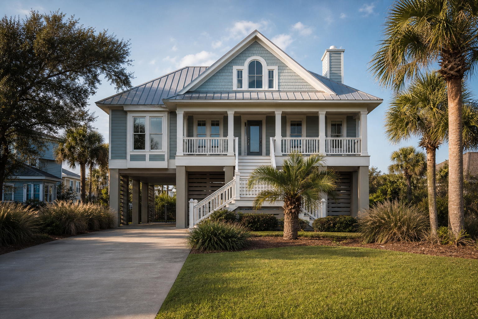
The City of Galveston's 18-inch-above-BFE minimum for new construction and substantial improvements means that homes built or substantially rebuilt under current standards are, by design, sitting higher than older structures in the same flood zone. That elevation advantage typically translates to lower flood insurance premiums and, in some cases, a stronger resale position. When I'm helping a buyer compare an older beach house to a newer elevated build, the elevation certificate is one of the first documents I want to see, because the insurance cost difference can be significant enough to shift the real economics of the purchase.For buyers newer to the coastal market, the guide on securing your coastal property as a first-time buyer in Texas City walks through several of these same considerations in the context of getting started on the Gulf Coast.
Frequently Asked Questions
Do I need an elevation certificate to buy a house in Galveston County?
You are not required to have one to purchase flood insurance in Texas, according to the Texas Water Development Board. However, if the property is in a Special Flood Hazard Area and your lender requires flood insurance, getting a certificate can help you understand, and potentially lower, your premium. It is one of the most useful pieces of due diligence a coastal buyer can do, even when it is not mandatory.Will my lender require an elevation certificate for a coastal Texas property?
Some lenders do require flood-zone determinations and may ask for an elevation certificate on properties in high-risk flood zones, but requirements vary by lender and loan type. The best approach is to ask your lender directly, early in the process. My mortgage background means I can help flag this question before it becomes a last-minute surprise, verify the specific requirement with your own lender for your loan program.Can an elevation certificate lower flood insurance premiums in Galveston?
Yes, it can. Texas allows property owners to submit an elevation certificate to their insurer if it results in a lower NFIP premium, per the Texas Water Development Board. If a home sits above its base flood elevation, the certificate documents that advantage and the insurer can price accordingly. The savings can be meaningful, especially for elevated homes built to the City of Galveston's current 18-inch-above-BFE standard.Where do I get an elevation certificate in Galveston County?
Start by asking the seller, they may already have one from a prior survey or permit. If not, check with the local floodplain administrator; Galveston County's floodplain FAQ confirms that residents can obtain one through the local process. Texas does not keep them at the state level, so the local office is the right first call. If no existing certificate is on file, a licensed surveyor can prepare one.How do I know if a home is in a flood zone before I make an offer?
Use FEMA's National Flood Hazard Layer viewer to search the property address and pull a FIRMette, it shows the official flood zone designation. You can also check Galveston County's current and historical FEMA FIRM maps to see how the zone has changed over time. Both the City of Galveston and League City reference an effective FIRM date of August 15, 2019, confirm which municipal map applies to the specific property you're considering.Does a title company check flood-zone or elevation-certificate documents at closing?
The title company handles the closing and settlement of funds, but flood-zone and elevation documentation comes from FEMA, local floodplain sources, and the survey process, not from title itself. Buyers should complete their flood-zone due diligence during the option period, not wait for the closing table. If you're unsure what flood documents are in the file, ask your agent to help you track them down before you remove contingencies.If you're also navigating the seller-disclosure side of this process, the guide on seller disclosures in Galveston TX covers what sellers are required to disclose about flood history and prior damage.
Understanding elevation certificates before you fall in love with a coastal property is one of the best ways to protect yourself from a surprise insurance bill after closing. The flood zone, the elevation relative to BFE, and the local standards in force for that municipality all feed directly into what you'll pay to insure the home, and what it will cost the next buyer after you.
I work with coastal buyers across Galveston, Texas City, Jamaica Beach, Tiki Island, Bayou Vista, Crystal Beach, and the rest of Southeast Texas, and flood documentation is part of every coastal transaction I handle. If you're evaluating a property and want to work through what the flood maps and elevation data actually mean for your purchase, schedule a consultation and let's look at the numbers together before you make an offer.
Equal Housing Opportunity. April Aberle is licensed as a Real Estate Sales Agent regulated by the Texas Real Estate Commission (TREC). TREC Consumer Protection Notice | TREC Information About Brokerage Services. Each office is independently owned and operated. This article is general information only and is not legal, tax, or financial advice. Confirm flood insurance costs, coverage requirements, and elevation documentation with your insurer, lender, title company, or a licensed surveyor.